East Park, Holderness Road, Kingston upon Hull
Introduction
The photograph on this page of East Park, Holderness Road, Kingston upon Hull by Bernard Sharp as part of the Geograph project.
The Geograph project started in 2005 with the aim of publishing, organising and preserving representative images for every square kilometre of Great Britain, Ireland and the Isle of Man.

There are currently over 7.5m images from over 14,400 individuals and you can help contribute to the project by visiting https://www.geograph.org.uk
East Park, Holderness Road, Kingston upon Hull
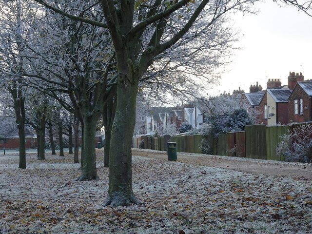
Image: © Bernard Sharp Taken: 13 Dec 2022
The sub-zero weather continues and, in addition to the already frozen pond, a very sharp overnight frost has left trees very white indeed. The footpath runs parallel with the rear of the houses in Westminster Avenue. East Park, opened in 1887, is Grade II Listed: https://www.historicengland.org.uk/listing/the-list/list-entry/1001519. Wikipedia: https://en.wikipedia.org/wiki/East_Park,_Kingston_upon_Hull
Images are licensed for reuse under creativecommons.org/licenses/by-sa/2.0
Image Location
Latitude
53.764507
Longitude
-0.297393