The location of the former Wortwell Station
Introduction
The photograph on this page of The location of the former Wortwell Station by Adrian S Pye as part of the Geograph project.
The Geograph project started in 2005 with the aim of publishing, organising and preserving representative images for every square kilometre of Great Britain, Ireland and the Isle of Man.

There are currently over 7.5m images from over 14,400 individuals and you can help contribute to the project by visiting https://www.geograph.org.uk
The location of the former Wortwell Station
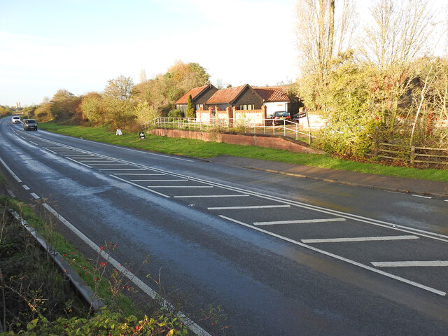
Image: © Adrian S Pye Taken: 24 Nov 2022
The station house and 180 feet platform was situated roughly where the path terminates. The 'platform' in the background is in the original location but has been rebuilt on a smaller scale. Wortwell Station was built in the second phase, Harleston to Bungay and opened in January 1861, and was closed in January 1878, as an economy measure. The station house became the gatekeeper's house. The Tunbeck Road level crossing #44 was just to the right of the scene.
Images are licensed for reuse under creativecommons.org/licenses/by-sa/2.0
Image Location
Latitude
52.415931
Longitude
1.34364