View of Stonehaven
Introduction
The photograph on this page of View of Stonehaven by Bill Harrison as part of the Geograph project.
The Geograph project started in 2005 with the aim of publishing, organising and preserving representative images for every square kilometre of Great Britain, Ireland and the Isle of Man.

There are currently over 7.5m images from over 14,400 individuals and you can help contribute to the project by visiting https://www.geograph.org.uk
View of Stonehaven
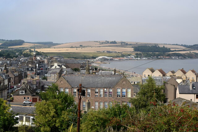
Image: © Bill Harrison Taken: 14 Aug 2022
The large building in the foreground is Dunnottar Primary School, dating from 1889 and C-listed: LB50260 http://portal.historicenvironment.scot/designation/LB50260 .
Images are licensed for reuse under creativecommons.org/licenses/by-sa/2.0
Image Location
Latitude
56.961103
Longitude
-2.207503