Bird Grove, George Eliot Street
Introduction
The photograph on this page of Bird Grove, George Eliot Street by A J Paxton as part of the Geograph project.
The Geograph project started in 2005 with the aim of publishing, organising and preserving representative images for every square kilometre of Great Britain, Ireland and the Isle of Man.

There are currently over 7.5m images from over 14,400 individuals and you can help contribute to the project by visiting https://www.geograph.org.uk
Bird Grove, George Eliot Street
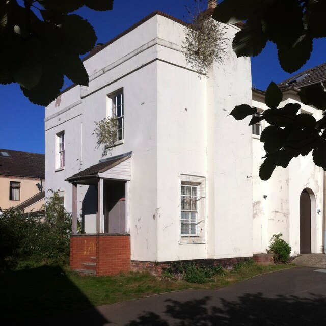
Image: © A J Paxton Taken: 1 Oct 2022
Bird Grove is the house where Mary Ann Evans, the future George Eliot, lived with her father Robert Evans from 1841 until his death in 1849, and where she nursed him through his final illness. These Coventry years were formative for Eliot. She lost the evangelical Christian faith of her youth and this brought her into severe conflict with her father (see Image]). Friendship with freethinking liberals and social reformers in the city such as the Brays and the Hennells opened new intellectual avenues for her Image The house has been in a poor state for many years and is listed as 'at risk' by the Coventry Society, which in 2017 published a plea for its preservation https://www.coventrysociety.org.uk/buildings-at-risk/bird-grove-house/ . The accompanying illustration shows a pair of houses, of which only one, the Eliot house, survives. It was used as an evangelical church and later as a Bangladeshi cultural and educational centre, but by 2017 it was vacant. In 2022 it looked shabby and overgrown, but new signs had appeared outside, one for an Arabic school, another in English and Bengali, depicting George Eliot and her association with the building, alongside photos and descriptions of two great Bengali poets and social reformers: Rabrindranath Tagore and Kazi Nazul Islam, who is revered as the national poet of Bangladesh.
Images are licensed for reuse under creativecommons.org/licenses/by-sa/2.0
Image Location
Latitude
52.420018
Longitude
-1.505455