Clydebank, Paisley and Glasgow Airport
Introduction
The photograph on this page of Clydebank, Paisley and Glasgow Airport by Stephen Sweeney as part of the Geograph project.
The Geograph project started in 2005 with the aim of publishing, organising and preserving representative images for every square kilometre of Great Britain, Ireland and the Isle of Man.

There are currently over 7.5m images from over 14,400 individuals and you can help contribute to the project by visiting https://www.geograph.org.uk
Clydebank, Paisley and Glasgow Airport
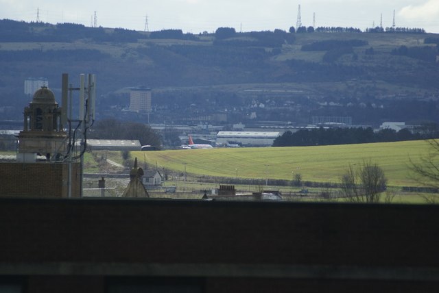
Image: © Stephen Sweeney Taken: 22 Mar 2008
Fine view across Glasgow's western conurbation. In the foreground the clock tower of Clydebank Town Hall can be seen. Just to the right, we see an Easyjet Airbus A319 taxiing on the runway at Glasgow Airport, having just landed. The highrise flats in the background are in the town of Paisley.
Images are licensed for reuse under creativecommons.org/licenses/by-sa/2.0
Image Location
Latitude
55.901396
Longitude
-4.409225