Crown Point
Introduction
The photograph on this page of Crown Point by Gerald England as part of the Geograph project.
The Geograph project started in 2005 with the aim of publishing, organising and preserving representative images for every square kilometre of Great Britain, Ireland and the Isle of Man.

There are currently over 7.5m images from over 14,400 individuals and you can help contribute to the project by visiting https://www.geograph.org.uk
Crown Point
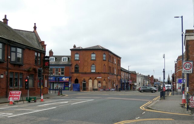
Image: © Gerald England Taken: 12 Nov 2022
The junction of A57 with the A6017 is traditionally known as Crown Point. On one corner is the Red Lion Image On the opposite corner was The George Fitzpatrick Image which for a short time in the late 20th century was called the Crown Point. It is now boarded up pending conversion into a restaurant with apartments above.
Images are licensed for reuse under creativecommons.org/licenses/by-sa/2.0
Image Location
Latitude
53.456199
Longitude
-2.113812