Candleriggs
Introduction
The photograph on this page of Candleriggs by Andy Waddington as part of the Geograph project.
The Geograph project started in 2005 with the aim of publishing, organising and preserving representative images for every square kilometre of Great Britain, Ireland and the Isle of Man.

There are currently over 7.5m images from over 14,400 individuals and you can help contribute to the project by visiting https://www.geograph.org.uk
Candleriggs
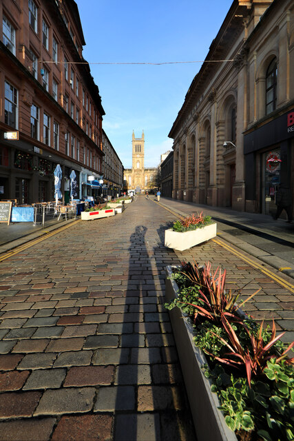
Image: © Andy Waddington Taken: 29 Nov 2022
Whilst open to motor traffic, Candleriggs is not really car-friendly having been converted to a sort of chicane by traffic-calming plant troughs. It's as well to remain cautious though, taxis and Ubers will use anything legal to cut their journey times... At lunchtime, the sun (if it is shining at all) illuminates the front of Ramshorn Kirk, now a theatre but formerly St. Paul's and St. David's Church. Cafés on the left give the opportunity to sit and have lunch whilst the clouds roll in, giving a welcome reduction in contrast for afternoon photography later.
Images are licensed for reuse under creativecommons.org/licenses/by-sa/2.0
Image Location
Latitude
55.85947
Longitude
-4.245226