Fordyce Old Kirk
Introduction
The photograph on this page of Fordyce Old Kirk by Bill Harrison as part of the Geograph project.
The Geograph project started in 2005 with the aim of publishing, organising and preserving representative images for every square kilometre of Great Britain, Ireland and the Isle of Man.

There are currently over 7.5m images from over 14,400 individuals and you can help contribute to the project by visiting https://www.geograph.org.uk
Fordyce Old Kirk
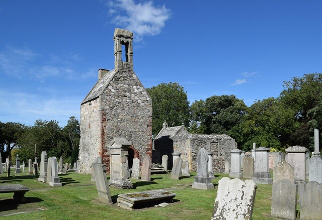
Image: © Bill Harrison Taken: 10 Aug 2022
The ruined kirk and kirkyard is a scheduled monument: SM352 http://portal.historicenvironment.scot/designation/SM352 . For the complex history of the site, see the listing.
Images are licensed for reuse under creativecommons.org/licenses/by-sa/2.0
Image Location
Latitude
57.662424
Longitude
-2.746314