Percy Street
Introduction
The photograph on this page of Percy Street by Gerald England as part of the Geograph project.
The Geograph project started in 2005 with the aim of publishing, organising and preserving representative images for every square kilometre of Great Britain, Ireland and the Isle of Man.

There are currently over 7.5m images from over 14,400 individuals and you can help contribute to the project by visiting https://www.geograph.org.uk
Percy Street
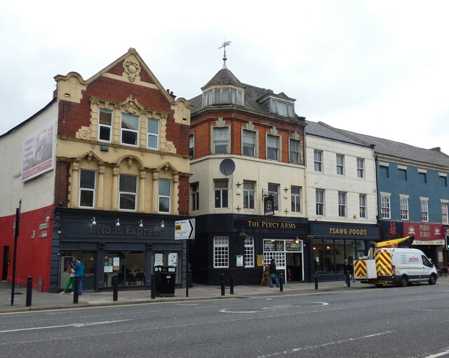
Image: © Gerald England Taken: 19 Oct 2022
Bill Henderson's photograph from 2006 shows how the street level appearance has changed over the years. The building on the left was then "Kiddie Kot". Now it is a nail bar. The Percy Arms in the middle has had a makeover whilst Tsang Foods next door has also been spruced up. The street bollards have also been modernised. Image Image
Images are licensed for reuse under creativecommons.org/licenses/by-sa/2.0
Image Location
Latitude
54.976215
Longitude
-1.616112