Steps off Greville Road, Warwick
Introduction
The photograph on this page of Steps off Greville Road, Warwick by Robin Stott as part of the Geograph project.
The Geograph project started in 2005 with the aim of publishing, organising and preserving representative images for every square kilometre of Great Britain, Ireland and the Isle of Man.

There are currently over 7.5m images from over 14,400 individuals and you can help contribute to the project by visiting https://www.geograph.org.uk
Steps off Greville Road, Warwick
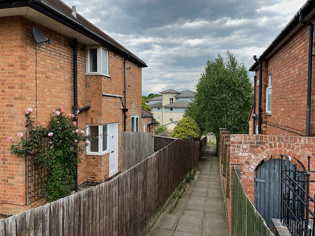
Image: © Robin Stott Taken: 2 Jun 2022
They lead down to a track, the continuation of Portobello Way, that gives access to the Percy Estate allotments, the rear of Greville Road properties, and an electricity pylon. In the background is one of the blocks of flats on the Waterfront development on the site of the Potterton's boiler factory. Greville was a family name of the Earls of Warwick.
Images are licensed for reuse under creativecommons.org/licenses/by-sa/2.0
Image Location


Leaflet Map data © OpenStreetMap
Latitude
52.292405
Longitude
-1.563325