Railway bridge over Chigwell Lane, Debden
Introduction
The photograph on this page of Railway bridge over Chigwell Lane, Debden by Stephen McKay as part of the Geograph project.
The Geograph project started in 2005 with the aim of publishing, organising and preserving representative images for every square kilometre of Great Britain, Ireland and the Isle of Man.

There are currently over 7.5m images from over 14,400 individuals and you can help contribute to the project by visiting https://www.geograph.org.uk
Railway bridge over Chigwell Lane, Debden
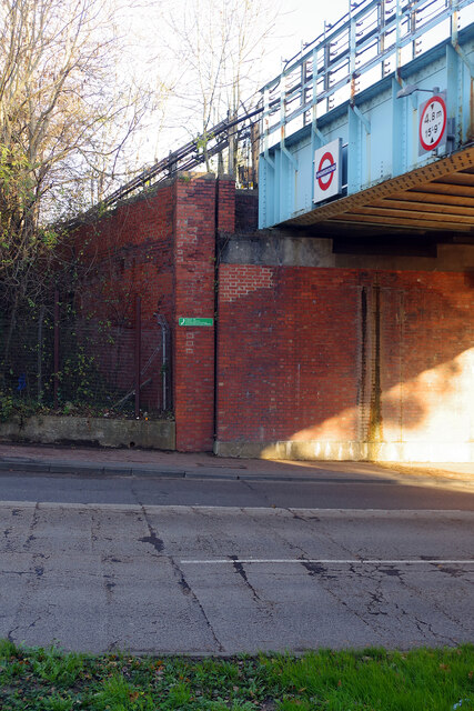
Image: © Stephen McKay Taken: 22 Nov 2022
The bridge carries the Central Line over Chigwell Lane, adjacent to Debden Station. The railway opened in 1865 when the station, in what must then have been a very rural area, was called Chigwell Lane (initially for a few months it was Chigwell Road). It became part of the London Underground network in 1949 when it was renamed Debden. This change coincided with the development of London County Council's Debden Estate.
Images are licensed for reuse under creativecommons.org/licenses/by-sa/2.0
Image Location


Leaflet Map data © OpenStreetMap
Latitude
51.644861
Longitude
0.082399