Old Boundary Marker in the Oldbury Court Estate, Bristol
Introduction
The photograph on this page of Old Boundary Marker in the Oldbury Court Estate, Bristol by S Kosciow as part of the Geograph project.
The Geograph project started in 2005 with the aim of publishing, organising and preserving representative images for every square kilometre of Great Britain, Ireland and the Isle of Man.

There are currently over 7.5m images from over 14,400 individuals and you can help contribute to the project by visiting https://www.geograph.org.uk
Old Boundary Marker in the Oldbury Court Estate, Bristol
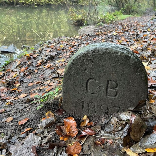
Image: © S Kosciow Taken: 20 Nov 2022
Municipal Boundary Marker beside a footpath in the Oldbury Court Estate on the south bank of the River Frome. On the former boundary of Stapleton and Mangotsfield parishes. Stapleton became part of Bristol parish and the city on 1 April 1898. Now entirely in Bristol with the boundary of Bristol and Winterbourne on the north bank of the river. It’s unclear why the stone is dated before the city boundary was moved. Milestone Society National ID: GL_BRIS30pb
Images are licensed for reuse under creativecommons.org/licenses/by-sa/2.0
Image Location


Leaflet Map data © OpenStreetMap
Latitude
51.492454
Longitude
-2.52222