More than a windmill
Introduction
The photograph on this page of More than a windmill by Neil Owen as part of the Geograph project.
The Geograph project started in 2005 with the aim of publishing, organising and preserving representative images for every square kilometre of Great Britain, Ireland and the Isle of Man.

There are currently over 7.5m images from over 14,400 individuals and you can help contribute to the project by visiting https://www.geograph.org.uk
More than a windmill
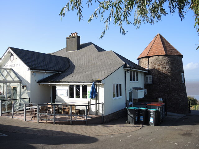
Image: © Neil Owen Taken: 26 Oct 2022
According to the pub's history, a windmill was built here in the 1830s, but was out of favour in the 1840s when a steam-powered mill started in town. It was then converted into residential use. By 1905 the landowners, Bristol Corporation, decided to create a golf course on the headlands and asked the famous player, Harry Vardon, to design it. The building became the club house. During times of war, the course closed and part of it used for agriculture. In the Second World War the clubhouse was occupied by the Home Guard. Once peace was established, the building became an office until 1960, when it was changed to a pub. Initially called the "Hole in One", it became The Windmill in 2000. The adjoining golf course had been reduced to a pitch and putt, but has recently closed due to issues with public footpaths. There are moves to turn the open space into a town green.
Images are licensed for reuse under creativecommons.org/licenses/by-sa/2.0
Image Location


Leaflet Map data © OpenStreetMap
Latitude
51.486462
Longitude
-2.781691