Willand : Verbeer Manor
Introduction
The photograph on this page of Willand : Verbeer Manor by Lewis Clarke as part of the Geograph project.
The Geograph project started in 2005 with the aim of publishing, organising and preserving representative images for every square kilometre of Great Britain, Ireland and the Isle of Man.

There are currently over 7.5m images from over 14,400 individuals and you can help contribute to the project by visiting https://www.geograph.org.uk
Willand : Verbeer Manor
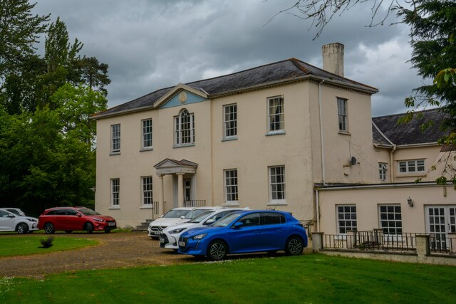
Image: © Lewis Clarke Taken: 12 May 2022
Formerly a substantial house. Circa early C16 with late C16 alterations (reset datestone, 1598), with additions of the 1790s.
Images are licensed for reuse under creativecommons.org/licenses/by-sa/2.0
Image Location


Leaflet Map data © OpenStreetMap
Latitude
50.877822
Longitude
-3.379677