Dinton houses [13]
Introduction
The photograph on this page of Dinton houses [13] by Michael Dibb as part of the Geograph project.
The Geograph project started in 2005 with the aim of publishing, organising and preserving representative images for every square kilometre of Great Britain, Ireland and the Isle of Man.

There are currently over 7.5m images from over 14,400 individuals and you can help contribute to the project by visiting https://www.geograph.org.uk
Dinton houses [13]
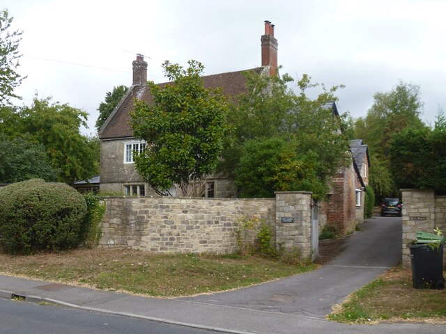
Image: © Michael Dibb Taken: 30 Aug 2022
Fitz Farmhouse, Hindon Road, was built in 1713, altered in the late 18th century and in the late 19th century. Constructed of rubble stone under a roof partly of tile and partly of slate. Attached to the rear and linked by a 19th century covered passage are some brick outbuildings with Welsh slate roofs now stores and garages. Listed, grade II, with details at: https://historicengland.org.uk/listing/the-list/list-entry/1318757 Dinton is a village in the Nadder valley, in Wiltshire, about 8¼ miles west of Salisbury and some 10½ miles northeast of Shaftesbury. Evidence of ancient settlement in the area is plentiful, including Grim's Ditch, Hanging Langford Camp, an Iron Age settlement, and the hill fort of Wick Ball Camp. Dinton is now a commuter village with most working residents travelling to Salisbury.
Images are licensed for reuse under creativecommons.org/licenses/by-sa/2.0
Image Location
Latitude
51.083366
Longitude
-1.978849