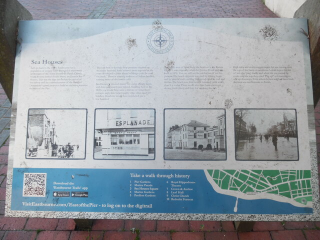
Sea Houses Information Board, Eastbourne
Introduction
The photograph on this page of Sea Houses Information Board, Eastbourne by David Hillas as part of the Geograph project.
The Geograph project started in 2005 with the aim of publishing, organising and preserving representative images for every square kilometre of Great Britain, Ireland and the Isle of Man.
There are currently over 7.5m images from over 14,400 individuals and you can help contribute to the project by visiting https://www.geograph.org.uk

Image: © David Hillas Taken: 28 Sep 2022
This information board is located in Sea Houses Square between Marine Parade and Seaside and has been provided by the East of the Pier Heritage Trust. It has the following wording: Sea Houses First column Let's go back to the 1840s. Eastbourne has a population of around 3,000 arranged in three main settlements of the Town around the Parish Church, South Bourne (today's South Street) and here at Sea Houses. This was the time just before the arrival of the railway and the commencement of the Duke of Devonshire's grand project to build an exclusive resort to the west of the Pier. Image of Sea Houses (now Marine Road?) Second column The café here is the only shop premises on the entire seafront. Strict controls were imposed as the town developed to limit where buildings could be used for 'trade'. There is a strong tradition of Italian families running many of the town's cafés. Sea Houses is situated mainly on a large shingle bank, with low-lying marsh just behind. Standing here in the 1840s you would have seen a mixture of fishermen's cottages and a few better quality villas often used for holidays. Residents would have numbered just a few hundred. Image of the former Esplanade Café Third column Just to the west of here along the Seafront is the Riviera Hotel. It was originally called the Anchor Hotel and was built in 1836. You can see the anchor motif on the parapet. The beach opposite was used by fishing boats and by general craft carrying bulk goods such as coal and timber. The beach was then several hundred yards wider than it is today. There would also have been some net drying sheds (dees) and huts for smoking the fish. Image of the former Albion and Anchor Hotels in Marine Parade Fourth column High tides and storm surges meant the sea coming over the top of the bank on occasions. Locals kept a bucket of wet clay (pug) handy and when the sea started to come over the top they cried 'Pug up!' as a warning to seal up doorways. Even when the sea wall had been built, the area was not immune to floods. Image of Seaside in flooding. Lower section Map of Eastbourne town centre and sea front with the following numbered items indicated on it. 1) Pier Gardens 2) Marine Parade 3) Sea Houses Square 4) Marine Gardens 5) Pavilion Gardens 6) Royal Hippodrome Theatre 7) Crown & Anchor 8) Leaf Hall 9) Christ Church 10) Redoubt Fortress

