St Ronan's Well
Introduction
The photograph on this page of St Ronan's Well by Pete Marrison as part of the Geograph project.
The Geograph project started in 2005 with the aim of publishing, organising and preserving representative images for every square kilometre of Great Britain, Ireland and the Isle of Man.

There are currently over 7.5m images from over 14,400 individuals and you can help contribute to the project by visiting https://www.geograph.org.uk
St Ronan's Well
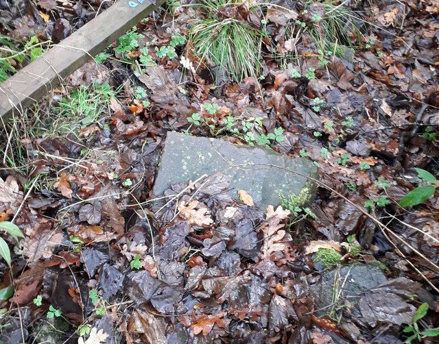
Image: © Pete Marrison Taken: 17 Nov 2022
These are the remnants of St Ronan's Well. A depression approximately 700mm in dia and 200mm deep. It is filled with mud, leaves and discarded pieces of masonry. It is adjacent to and south of, the brick built water tank which apparently replaced the original well. Were it not for presence of the water tank, the position of St Ronan's well would be almost impossible to locate. It is located beneath the existing barbed wire fence. St Ronan would be disappointed.
Images are licensed for reuse under creativecommons.org/licenses/by-sa/2.0
Image Location
Latitude
56.056515
Longitude
-4.495511