Old Boundary Marker on the A614 Doncaster Road, Finningley
Introduction
The photograph on this page of Old Boundary Marker on the A614 Doncaster Road, Finningley by R Heywood as part of the Geograph project.
The Geograph project started in 2005 with the aim of publishing, organising and preserving representative images for every square kilometre of Great Britain, Ireland and the Isle of Man.

There are currently over 7.5m images from over 14,400 individuals and you can help contribute to the project by visiting https://www.geograph.org.uk
Old Boundary Marker on the A614 Doncaster Road, Finningley
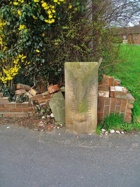
Image: © R Heywood Taken: Unknown
County Boundary Marker against a brick garden wall on the northwest side of the junction of the A614 Doncaster Road and Honeysuckle Court. Words are WEST RIDING C C on the left face, NOTTS C C on the right face, both vertically and COUNTY on its top. On the boundary of Blaxton and Finningley parishes, Finningley was in Nottinghamshire until 1974 and thereafter both were in South Yorkshire and Doncaster. Milestone Society National ID: YW_BLAFIN01cb
Images are licensed for reuse under creativecommons.org/licenses/by-sa/2.0
Image Location
Latitude
53.486652
Longitude
-0.990441