Blue direction signs, Wareham, Dorset
Introduction
The photograph on this page of Blue direction signs, Wareham, Dorset by Jaggery as part of the Geograph project.
The Geograph project started in 2005 with the aim of publishing, organising and preserving representative images for every square kilometre of Great Britain, Ireland and the Isle of Man.

There are currently over 7.5m images from over 14,400 individuals and you can help contribute to the project by visiting https://www.geograph.org.uk
Blue direction signs, Wareham, Dorset
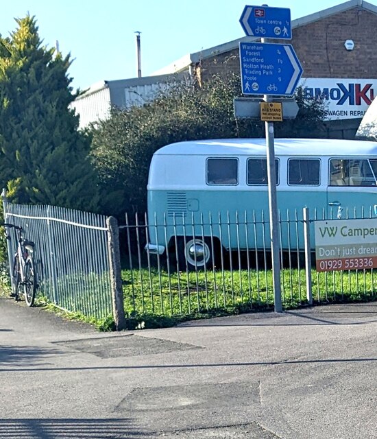
Image: © Jaggery Taken: 12 Nov 2022
The signs on the left here https://www.geograph.org.uk/photo/7339735 are for walkers and cyclists. Left for Wareham railway station (nearby) and Wareham town centre (½ mile). Right for Wareham Forest (¾), Sandford (1½), Holton Heath Trading Park (3), Poole (9).
Images are licensed for reuse under creativecommons.org/licenses/by-sa/2.0
Image Location


Leaflet Map data © OpenStreetMap
Latitude
50.693391
Longitude
-2.114625