Britannia Point
Introduction
The photograph on this page of Britannia Point by Ian Capper as part of the Geograph project.
The Geograph project started in 2005 with the aim of publishing, organising and preserving representative images for every square kilometre of Great Britain, Ireland and the Isle of Man.

There are currently over 7.5m images from over 14,400 individuals and you can help contribute to the project by visiting https://www.geograph.org.uk
Britannia Point
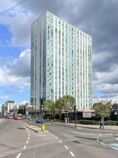
Image: © Ian Capper Taken: 7 Oct 2022
Originally built in 1966 as an office block named Lyon House, but more generally known as Colliers Wood Tower. It was considered one of the ugliest buildings in London. A major renovation was carried out 2014-7 which saw its conversion to residential apartments.
Images are licensed for reuse under creativecommons.org/licenses/by-sa/2.0
Image Location
Latitude
51.41732
Longitude
-0.17858