East Hetton Colliery Land Reclamation, Co. Durham
Introduction
The photograph on this page of East Hetton Colliery Land Reclamation, Co. Durham by Philip Soakell as part of the Geograph project.
The Geograph project started in 2005 with the aim of publishing, organising and preserving representative images for every square kilometre of Great Britain, Ireland and the Isle of Man.

There are currently over 7.5m images from over 14,400 individuals and you can help contribute to the project by visiting https://www.geograph.org.uk
East Hetton Colliery Land Reclamation, Co. Durham
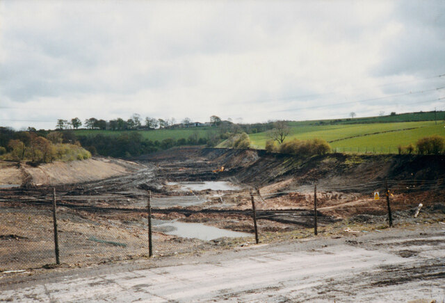
Image: © Philip Soakell Taken: Unknown
Removal of the coal slurry waste from the bottom of Kelloe Valley. During coal mining operations prior to 1983 at East Hetton Colliery, a dam had been constructed across the valley to retain and store the coal slurry waste that was produced from the coal washing plant. The reclamation works required the removal of the slurry from the valley, transporting it, and mixing it with the red shale of the pit heap to remodel the contours of the existing landscape. Image] Image]
Images are licensed for reuse under creativecommons.org/licenses/by-sa/2.0
Image Location
Latitude
54.724613
Longitude
-1.456398