School Street, Honeybourne
Introduction
The photograph on this page of School Street, Honeybourne by Derek Harper as part of the Geograph project.
The Geograph project started in 2005 with the aim of publishing, organising and preserving representative images for every square kilometre of Great Britain, Ireland and the Isle of Man.

There are currently over 7.5m images from over 14,400 individuals and you can help contribute to the project by visiting https://www.geograph.org.uk
School Street, Honeybourne
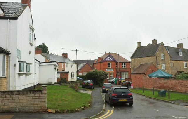
Image: © Derek Harper Taken: 14 Sep 2021
Seen across the High Street, The prominent building in the centre is Honeybourne Primary Academy. On the right is part of The Manor House, "dated 1627 ..." https://historicengland.org.uk/listing/the-list/list-entry/1350024?section=official-list-entry .
Images are licensed for reuse under creativecommons.org/licenses/by-sa/2.0
Image Location
Latitude
52.09225
Longitude
-1.835018