Mileplate, B4057, Patchway Roundabout
Introduction
The photograph on this page of Mileplate, B4057, Patchway Roundabout by Roadside Relics as part of the Geograph project.
The Geograph project started in 2005 with the aim of publishing, organising and preserving representative images for every square kilometre of Great Britain, Ireland and the Isle of Man.

There are currently over 7.5m images from over 14,400 individuals and you can help contribute to the project by visiting https://www.geograph.org.uk
Mileplate, B4057, Patchway Roundabout
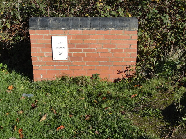
Image: © Roadside Relics Taken: 4 Nov 2020
The mileplate is located on a short section of brick wall on the north side of the roundabout exit on to the B4057. The wall and mileplate were erected between October 2008 and June 2014, but the mileplate is now missing. Parish of Patchway (City of Bristol district). Inscription reads:- TO / Briftol / 5 Milestone Society National ID: SO_BRGL05R
Images are licensed for reuse under creativecommons.org/licenses/by-sa/2.0
Image Location
Latitude
51.532731
Longitude
-2.569693