Newton Cap Viaduct, Bishop Auckland
Introduction
The photograph on this page of Newton Cap Viaduct, Bishop Auckland by Philip Soakell as part of the Geograph project.
The Geograph project started in 2005 with the aim of publishing, organising and preserving representative images for every square kilometre of Great Britain, Ireland and the Isle of Man.

There are currently over 7.5m images from over 14,400 individuals and you can help contribute to the project by visiting https://www.geograph.org.uk
Newton Cap Viaduct, Bishop Auckland
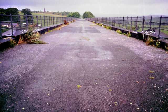
Image: © Philip Soakell Taken: 13 Sep 1993
Newton Cap Viaduct was originally built between 1854 and 1857 to carry the Bishop Auckland to Durham railway across the River Wear Construction works took place between 1993 and 1995 to convert the viaduct to carry road traffic (A689) over the River Wear. Image]
Images are licensed for reuse under creativecommons.org/licenses/by-sa/2.0
Image Location
Latitude
54.66691
Longitude
-1.681824