Toll Bar Cottage, Mossley. A635
Introduction
The photograph on this page of Toll Bar Cottage, Mossley. A635 by Nigel Upton as part of the Geograph project.
The Geograph project started in 2005 with the aim of publishing, organising and preserving representative images for every square kilometre of Great Britain, Ireland and the Isle of Man.

There are currently over 7.5m images from over 14,400 individuals and you can help contribute to the project by visiting https://www.geograph.org.uk
Toll Bar Cottage, Mossley. A635
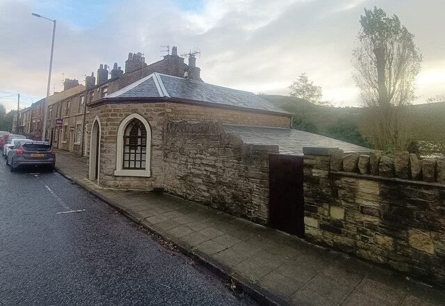
Image: © Nigel Upton Taken: 7 Nov 2022
On the SE side of Manchester Road. This Toll House was erected by the Ridgehill & Lanes & Holehouse Turnpike Trust in the 19ᵗʰ Century. The frontal view is Image Grade II Listed, February 1986. Nᴼ 1068038 see https://historicengland.org.uk/listing/the-list/list-entry/1068038 Milestone Society National ID: MA.MOS02
Images are licensed for reuse under creativecommons.org/licenses/by-sa/2.0
Image Location
Latitude
53.521639
Longitude
-2.035165