The Toll House, Saddleworth. A669
Introduction
The photograph on this page of The Toll House, Saddleworth. A669 by Nigel Upton as part of the Geograph project.
The Geograph project started in 2005 with the aim of publishing, organising and preserving representative images for every square kilometre of Great Britain, Ireland and the Isle of Man.

There are currently over 7.5m images from over 14,400 individuals and you can help contribute to the project by visiting https://www.geograph.org.uk
The Toll House, Saddleworth. A669
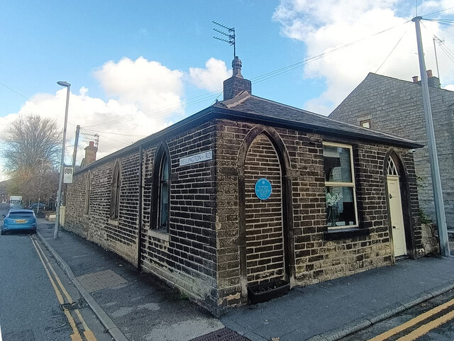
Image: © Nigel Upton Taken: 7 Nov 2022
On the corner of Chew Valley and Wellington Roads. Erected by the Standedge & Oldham Turnpike Trust in the 19ᵗʰ Century. The Blue plaque says it was used from build (about 1842) until the turnpike ceased in 1885. Grade II Listed, July 1986. Nᴼ 1067469 see https://historicengland.org.uk/listing/the-list/list-entry/1067469 Milestone Society National ID: MA.SAD01
Images are licensed for reuse under creativecommons.org/licenses/by-sa/2.0
Image Location
Latitude
53.537778
Longitude
-2.010886