
Bowes Castle [3]
Introduction
The photograph on this page of Bowes Castle [3] by Michael Dibb as part of the Geograph project.
The Geograph project started in 2005 with the aim of publishing, organising and preserving representative images for every square kilometre of Great Britain, Ireland and the Isle of Man.

There are currently over 7.5m images from over 14,400 individuals and you can help contribute to the project by visiting https://www.geograph.org.uk
Bowes Castle [3]
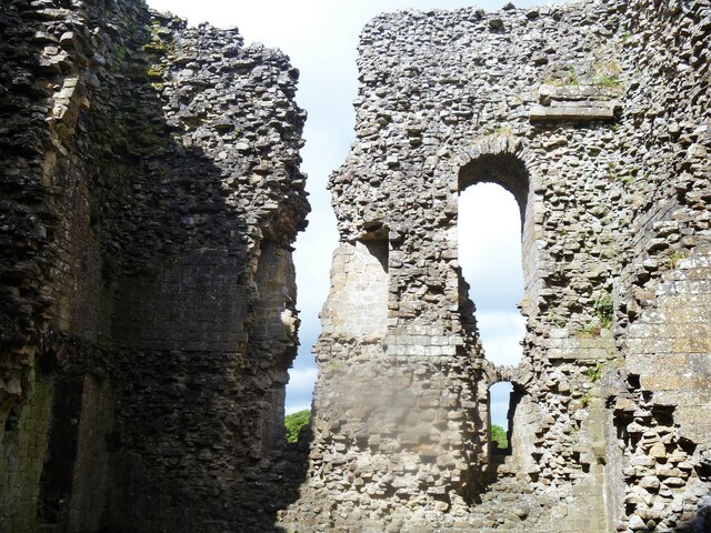
Image: © Michael Dibb Taken: 25 Jun 2022
Bowes Castle was built within the perimeter of the former Roman fort of Lavatrae, on the Roman road that is now the A66. The original timber castle was replaced by a sandstone rubble core faced with ashlar between 1170 and 1174 and a village was built alongside. The castle withstood a Scottish attack in 1174, but was looted in 1322. The castle declined and was largely dismantled after the English Civil War. The ruins are now in the care of English Heritage. Listed, grade I, with details at: https://historicengland.org.uk/listing/the-list/list-entry/1121039 A Scheduled Ancient Monument with much history and detail at: https://historicengland.org.uk/listing/the-list/list-entry/1002318 Bowes is a village in County Durham, some 14 miles northwest of Richmond and about 18½ miles due west of Darlington. Set on the north bank of the River Greta, the village was, until by-passed, astride the A66 trunk road. The Romans had a fort here, guarding the Stainmore pass over the Pennines, and their site was reused by the Normans who built a castle. The village grew around the castle, and the name Bowes is first mentioned in a charter of 1148.
Images are licensed for reuse under creativecommons.org/licenses/by-sa/2.0
Image Location

Latitude
54.516834
Longitude
-2.013344