Shitterton: approach road
Introduction
The photograph on this page of Shitterton: approach road by Chris Downer as part of the Geograph project.
The Geograph project started in 2005 with the aim of publishing, organising and preserving representative images for every square kilometre of Great Britain, Ireland and the Isle of Man.

There are currently over 7.5m images from over 14,400 individuals and you can help contribute to the project by visiting https://www.geograph.org.uk
Shitterton: approach road
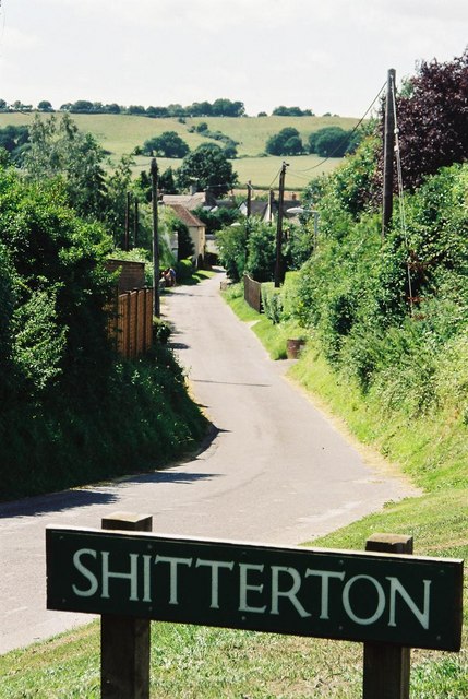
Image: © Chris Downer Taken: Unknown
This road leads down to the picturesque hamlet of Shitterton. The village's name causes the sign to be stolen frequently, this it is often replaced and keeps up with the design of the time. In 2006 it was white: Image The name of Shitterton was embarrassing enough to the Ordnance Survey that it dropped the H on its maps and called it Sitterton about 20 years ago. The H has recently been restored on both the 1:50,000 and 1:25,000 maps.
Images are licensed for reuse under creativecommons.org/licenses/by-sa/2.0
Image Location
Latitude
50.754562
Longitude
-2.224072