Northeast parapet of Harraby Bridge which takes A6 over River Petteril
Introduction
The photograph on this page of Northeast parapet of Harraby Bridge which takes A6 over River Petteril by Roger Templeman as part of the Geograph project.
The Geograph project started in 2005 with the aim of publishing, organising and preserving representative images for every square kilometre of Great Britain, Ireland and the Isle of Man.

There are currently over 7.5m images from over 14,400 individuals and you can help contribute to the project by visiting https://www.geograph.org.uk
Northeast parapet of Harraby Bridge which takes A6 over River Petteril
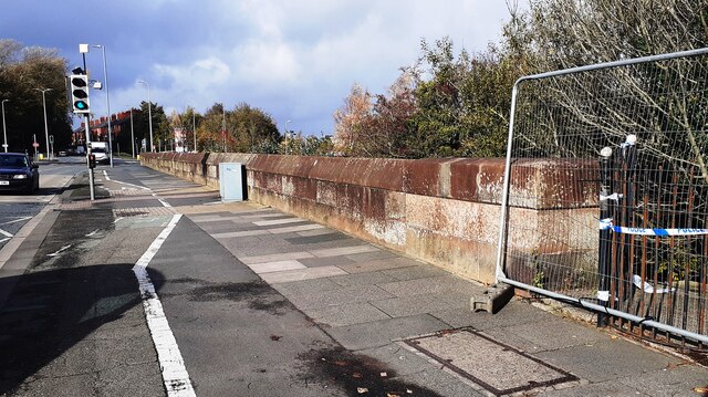
Image: © Roger Templeman Taken: 1 Nov 2022
Ordnance Survey documents indicate that a benchmark was levelled at 87.062 feet above Liverpool Datum on the near end of the parapet during the 1841-1844 Liverpool to Port Carlisle 1GL Survey. The surveyor's description was 'No. 466. Bolt in South-east pier of bridge, over River Petterill ; 3.28 ft. above pathway'
Images are licensed for reuse under creativecommons.org/licenses/by-sa/2.0
Image Location
Latitude
54.883414
Longitude
-2.915722