The Round House
Introduction
The photograph on this page of The Round House by Richard Croft as part of the Geograph project.
The Geograph project started in 2005 with the aim of publishing, organising and preserving representative images for every square kilometre of Great Britain, Ireland and the Isle of Man.

There are currently over 7.5m images from over 14,400 individuals and you can help contribute to the project by visiting https://www.geograph.org.uk
The Round House
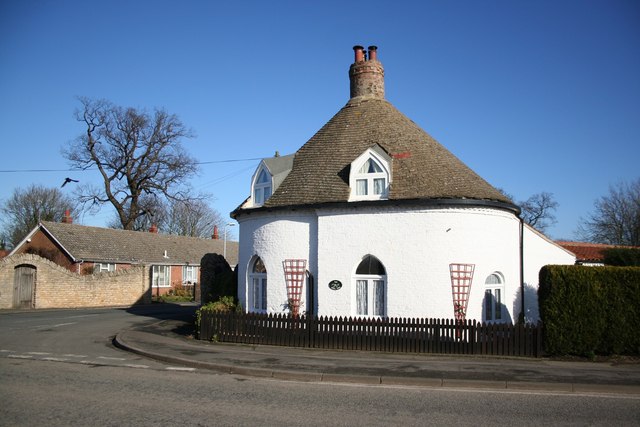
Image: © Richard Croft Taken: 6 Feb 2008
Attractive grade II listed early 19th century round cottage ornee with later additions. Originally one of a pair of thatched lodges either side of Park Avenue, leading to Algarkirk Hall, home of the Beridge family, squarsons of Algarkirk through the 18th and 19th centuries. The last squarson, Prebendary Basil Beridge was a great local benefactor and built churches at Amber Hill (1867) and Fosdyke (1871) out of his own pocket. He bequeathed the Hall and contents to the living of Algarkirk, but his legacy was squandered and the house was eventually pulled down in 1956. Thanks to Mrs.J.Ross for information
Images are licensed for reuse under creativecommons.org/licenses/by-sa/2.0
Image Location
Latitude
52.900671
Longitude
-0.08999