
Stone Stile SX0974a
Introduction
The photograph on this page of Stone Stile SX0974a by Anne Green as part of the Geograph project.
The Geograph project started in 2005 with the aim of publishing, organising and preserving representative images for every square kilometre of Great Britain, Ireland and the Isle of Man.

There are currently over 7.5m images from over 14,400 individuals and you can help contribute to the project by visiting https://www.geograph.org.uk
Stone Stile SX0974a
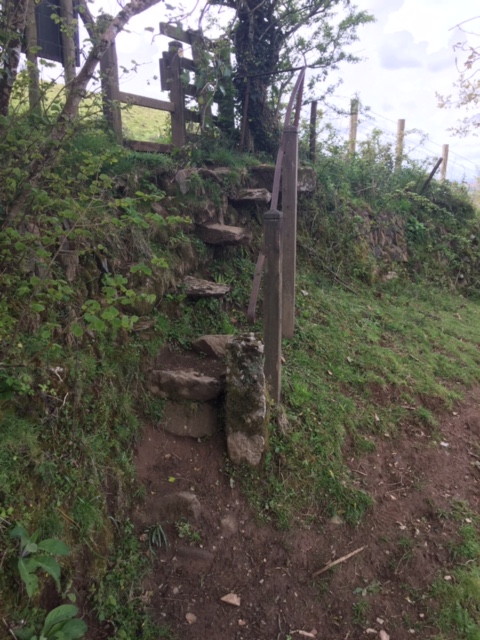
Image: © Anne Green Taken: 11 May 2021
Accessed across two fields from the hamlet of Pendrift (north of Blisland) at the top of the hill leading down to the valley known as Pendrift Bottoms. A steep sheep stile with a metal handrail - held in place by one metal and two wooden upright posts - to assist its use. It consists of 4 steps set into the stone face of the hedge - the top step holds the upright of the handrail - with 2, widely spaced, stone steps below these, and one stone set in the earth at the bottom to aid access. On FP No. 593/3/1 (Gold). The path originally gave quarry workers a short cut from Blisland and its surrounding hamlets to the de Lank quarry.
Images are licensed for reuse under creativecommons.org/licenses/by-sa/2.0
Image Location

Latitude
50.53827
Longitude
-4.68425