Former St Mary's Hall, Welles Street, Sandbach - datestone
Introduction
The photograph on this page of Former St Mary's Hall, Welles Street, Sandbach - datestone by Stephen Craven as part of the Geograph project.
The Geograph project started in 2005 with the aim of publishing, organising and preserving representative images for every square kilometre of Great Britain, Ireland and the Isle of Man.

There are currently over 7.5m images from over 14,400 individuals and you can help contribute to the project by visiting https://www.geograph.org.uk
Former St Mary's Hall, Welles Street, Sandbach - datestone
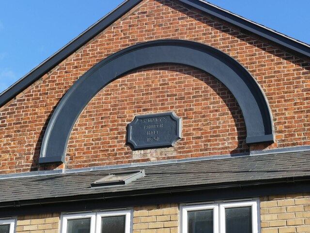
Image: © Stephen Craven Taken: 15 Oct 2022
Since 2014 the roof of the shop has been rebuilt at a lower pitch, revealing the gable of the old chapel more clearly and a previously hidden date stone of 1951 when it became St Mary's (Anglican) church hall soon after the Methodists ceased using it for worship in 1950. See Image for context.
Images are licensed for reuse under creativecommons.org/licenses/by-sa/2.0
Image Location
Latitude
53.144958
Longitude
-2.363856