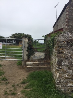
Stone Stile SW8947d
Introduction
The photograph on this page of Stone Stile SW8947d by John Stringer as part of the Geograph project.
The Geograph project started in 2005 with the aim of publishing, organising and preserving representative images for every square kilometre of Great Britain, Ireland and the Isle of Man.
There are currently over 7.5m images from over 14,400 individuals and you can help contribute to the project by visiting https://www.geograph.org.uk

Image: © John Stringer Taken: 10 Jun 2021
Opposite Probus Primary School, Chapel Street, Probus. On land owned by the Tredenham Trust an ancient local charity. The land has recently had a change of use from a meadow for retired ponies and is now allotments. West side: two stone steps and a vertical stone slab. East side: at ground level. The granite pillar is one of a new gateway pair but the style itself is ancient. The photographer has known it for 35 years. Not on a public footpath.

