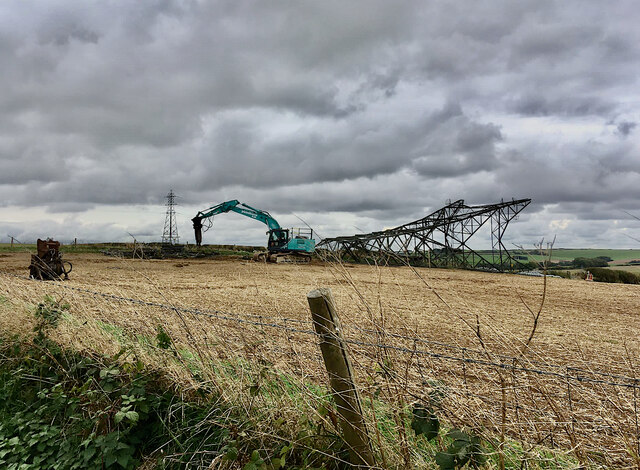
Pylon brought down, Dorset AONB (2/2)
Introduction
The photograph on this page of Pylon brought down, Dorset AONB (2/2) by Robin Stott as part of the Geograph project.
The Geograph project started in 2005 with the aim of publishing, organising and preserving representative images for every square kilometre of Great Britain, Ireland and the Isle of Man.
There are currently over 7.5m images from over 14,400 individuals and you can help contribute to the project by visiting https://www.geograph.org.uk

Image: © Robin Stott Taken: 30 Sep 2022
National Grid has undergrounded nearly nine kilometres of high-voltage transmission cables, then demolished and removed 22 pylons in this part of the Dorset Area of Outstanding Natural Beauty. The scheme is the first in a programme to enhance and restore landscape in Britain's AONBs and National Parks. See the Dorset AONB website https://www.dorsetaonb.org.uk/news/pylons-coming-down-in-dorset/ and that of National Grid https://www.nationalgrid.com/pylons-coming-down-dorset-major-national-grid-project-nears-completion Other pylons can be seen on the skyline. National Grid's sign apologises for any inconvenience. Locations were provided by the photographer for the purpose of this submission.

