Paxton Gardens, St Ann's
Introduction
The photograph on this page of Paxton Gardens, St Ann's by Stephen McKay as part of the Geograph project.
The Geograph project started in 2005 with the aim of publishing, organising and preserving representative images for every square kilometre of Great Britain, Ireland and the Isle of Man.

There are currently over 7.5m images from over 14,400 individuals and you can help contribute to the project by visiting https://www.geograph.org.uk
Paxton Gardens, St Ann's
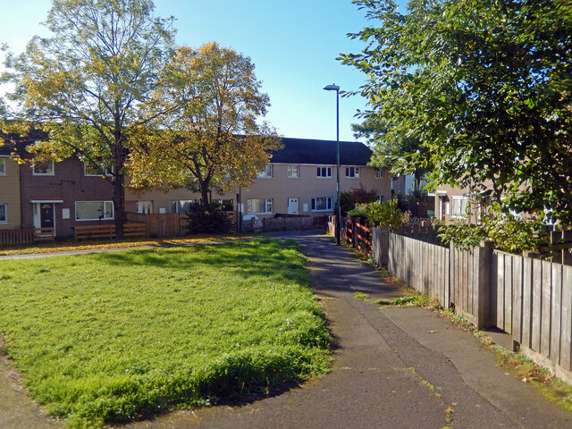
Image: © Stephen McKay Taken: 16 Oct 2022
The modern St Ann's, a large Nottingham inner city social housing area, is a good example of a Radburn estate - a design that was very fashionable from the 1960s to the 1980s. The idea was to ruthlessly separate cars and pedestrians so that all the houses face on to walkways and cars are kept on access roads behind walls at the rear. In this view rows of terraced houses look out on to a grassed patch with mature trees perhaps intended to emulate a village green. It does not look unpleasant on a sunny morning but experience with Radburn estates in general suggests that the confusing layout with myriad cut throughs and paths (and parking areas hidden from view) is unpopular and encourages crime. St Ann's was comprehensively redeveloped in the 1970s after the previous housing stock of poor quality 19th century terraced houses - specifically built for the working poor - was demolished.
Images are licensed for reuse under creativecommons.org/licenses/by-sa/2.0
Image Location
Latitude
52.957562
Longitude
-1.136276