Boundary of public highway
Introduction
The photograph on this page of Boundary of public highway by Neil Owen as part of the Geograph project.
The Geograph project started in 2005 with the aim of publishing, organising and preserving representative images for every square kilometre of Great Britain, Ireland and the Isle of Man.

There are currently over 7.5m images from over 14,400 individuals and you can help contribute to the project by visiting https://www.geograph.org.uk
Boundary of public highway
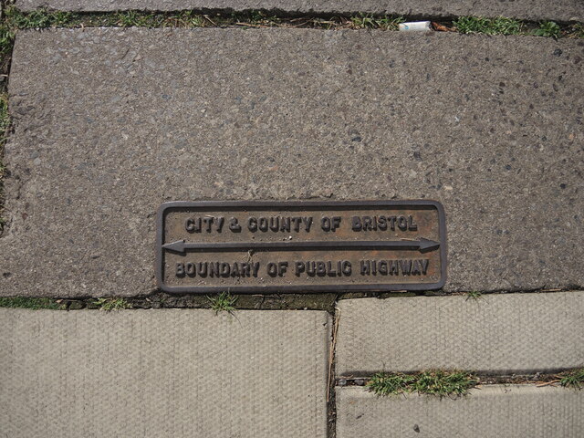
Image: © Neil Owen Taken: 30 Aug 2022
A small cast iron plate is set into the pavement in Queen Charlotte Street, one of several in the street. The modern pavement seems to have been extended.
Images are licensed for reuse under creativecommons.org/licenses/by-sa/2.0
Image Location
Latitude
51.452767
Longitude
-2.593594