OS Flush Bracket 2179 - Little Hangbank Bridge
Introduction
The photograph on this page of OS Flush Bracket 2179 - Little Hangbank Bridge by thejackrustles as part of the Geograph project.
The Geograph project started in 2005 with the aim of publishing, organising and preserving representative images for every square kilometre of Great Britain, Ireland and the Isle of Man.

There are currently over 7.5m images from over 14,400 individuals and you can help contribute to the project by visiting https://www.geograph.org.uk
OS Flush Bracket 2179 - Little Hangbank Bridge
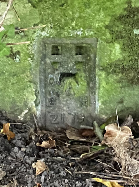
Image: © thejackrustles Taken: 21 Sep 2022
This area has a very unusual concentration of 2GL Flush Brackets https://www.bench-marks.org.uk/bm10212 https://www.bench-marks.org.uk/help/flush 2GL Series Flush brackets were first used during the 2nd Geodetic Levelling of England & Wales between 1912 and 1921. The 2GL series was numbered from OSBM 1 to OSBM 3000 and did not have a prefix letter. The vast majority of the flush brackets in the 2GL series were placed on walls and buildings, but a small number were used on triangulation pillars. There are 48 examples of these listed in the database, all in the range OSBM 2732 to OSBM 2999. In addition to England and Wales, the survey also covered part of the southeast of Scotland, in roughly the area between Newcastleton, Dunbar, and Berwick upon Tweed.
Images are licensed for reuse under creativecommons.org/licenses/by-sa/2.0
Image Location
Latitude
54.46764
Longitude
-1.669794