Commemorative Plate, Cinderford
Introduction
The photograph on this page of Commemorative Plate, Cinderford by Mr Red as part of the Geograph project.
The Geograph project started in 2005 with the aim of publishing, organising and preserving representative images for every square kilometre of Great Britain, Ireland and the Isle of Man.

There are currently over 7.5m images from over 14,400 individuals and you can help contribute to the project by visiting https://www.geograph.org.uk
Commemorative Plate, Cinderford
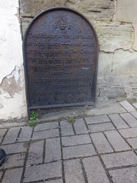
Image: © Mr Red Taken: 15 Oct 2022
On the wall of a house where Market and Victoria Streets concatenate. Grade II Listed, details https://historicengland.org.uk/listing/the-list/list-entry/1186466. Inscription: V (crown) R This road for the distance of 1100 ↢ yards was made at the expense of the crown for the benefit of the inhabitants and district 1897 - 8 E.Stafford Howard Esq Commissioner Philip Baylis Esq Dep Surveyor Milestone Society National ID: GL_CIND05cm
Images are licensed for reuse under creativecommons.org/licenses/by-sa/2.0
Image Location
Latitude
51.823358
Longitude
-2.500111