OS Bench Mark
Introduction
The photograph on this page of OS Bench Mark by Phil Johnstone as part of the Geograph project.
The Geograph project started in 2005 with the aim of publishing, organising and preserving representative images for every square kilometre of Great Britain, Ireland and the Isle of Man.

There are currently over 7.5m images from over 14,400 individuals and you can help contribute to the project by visiting https://www.geograph.org.uk
OS Bench Mark
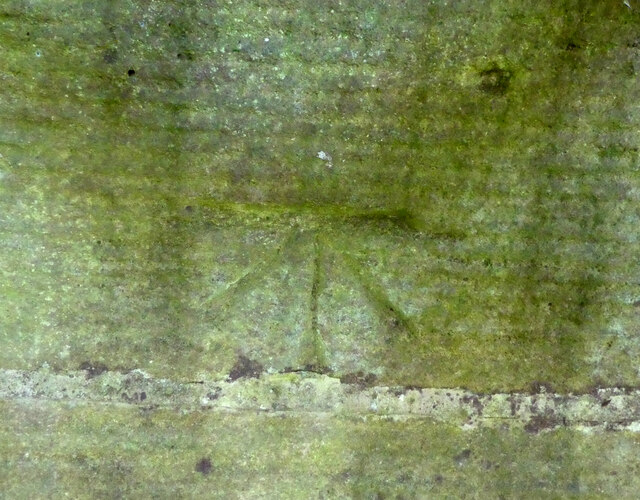
Image: © Phil Johnstone Taken: 8 Oct 2022
Ordnance Survey cut bench mark from the 19th century levelling on NE side of NE parapet of Potters Brook bridge on A6. Only visible by leaning over the parapet and holding the camera upside-down! 77.8 ft above old datum.
Images are licensed for reuse under creativecommons.org/licenses/by-sa/2.0
Image Location


Leaflet Map data © OpenStreetMap
Latitude
53.966137
Longitude
-2.779032