Druid Stone
Introduction
The photograph on this page of Druid Stone by Jonathan Clitheroe as part of the Geograph project.
The Geograph project started in 2005 with the aim of publishing, organising and preserving representative images for every square kilometre of Great Britain, Ireland and the Isle of Man.

There are currently over 7.5m images from over 14,400 individuals and you can help contribute to the project by visiting https://www.geograph.org.uk
Druid Stone
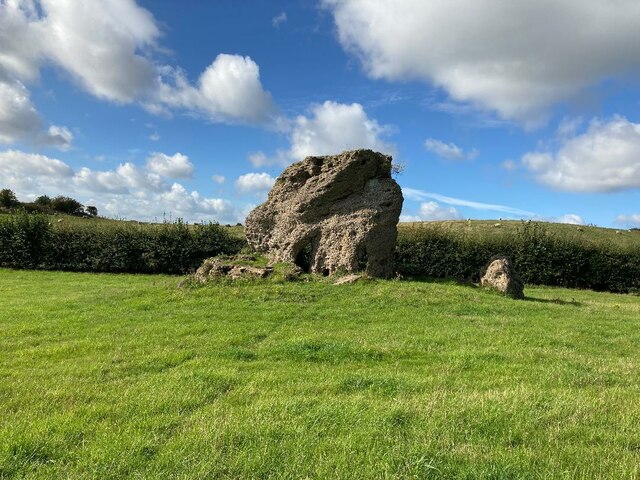
Image: © Jonathan Clitheroe Taken: 8 Oct 2022
Natural rock formation consisting of conglomerate material known as puddingstone. The hollowed-out area is due to human activity and may have been an attempt at a Solstice sunrise alignment. The site is well described on the Megalithic Portal website and a cluster of similarly-formed rocks can be found in a wooded area to the north west at SK574568, just off the Robin Hood Way.
Images are licensed for reuse under creativecommons.org/licenses/by-sa/2.0
Image Location
Latitude
53.096627
Longitude
-1.136033