Brough buildings [4]
Introduction
The photograph on this page of Brough buildings [4] by Michael Dibb as part of the Geograph project.
The Geograph project started in 2005 with the aim of publishing, organising and preserving representative images for every square kilometre of Great Britain, Ireland and the Isle of Man.

There are currently over 7.5m images from over 14,400 individuals and you can help contribute to the project by visiting https://www.geograph.org.uk
Brough buildings [4]
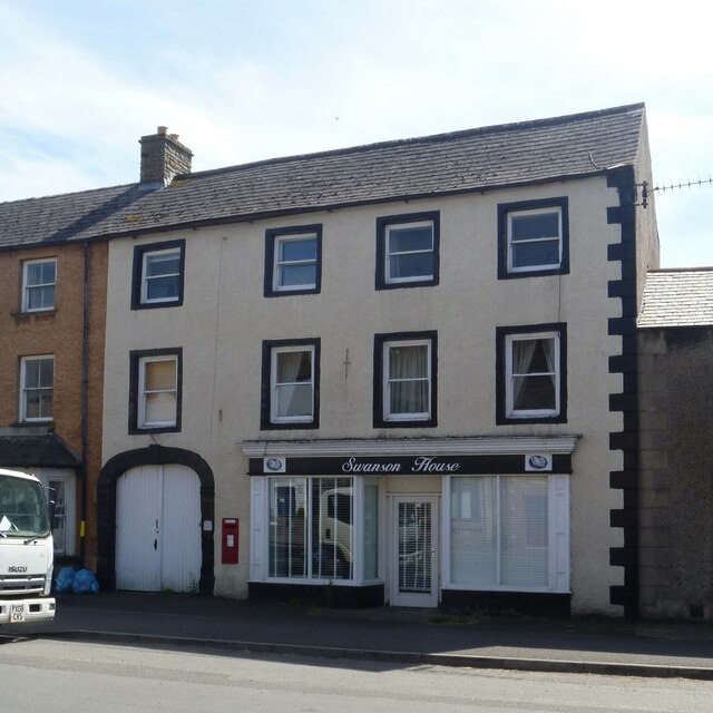
Image: © Michael Dibb Taken: 20 Jun 2022
Now purely residential, Swanson House has been, at various times, an inn, a post office, a bed and breakfast establishment and a restaurant. Probably built in the late 18th or early 19th century with later additions. Constructed of pebbledashed rubble stone under a Welsh slate roof. There is a carriage entrance to Swan Avenue on the left and a 19th century shopfront on the right. Listed, grade II, with details at: https://historicengland.org.uk/listing/the-list/list-entry/1326986 Brough is a village in the Eden district of Cumbria, some 21 miles northeast of Kendal and about 30 miles west of Darlington. The village is on the A66 road, a key route across the Pennine Mountains via the Stainmore Pass. Brough is on the site of the Roman fort of Verterae and has the ruins of a Norman castle. The village has historically been divided into Market Brough, to the north, and Church Brough, to the south.
Images are licensed for reuse under creativecommons.org/licenses/by-sa/2.0
Image Location
Latitude
54.526551
Longitude
-2.319012