Boundary Marker, Pollard's Lane, Blakeney
Introduction
The photograph on this page of Boundary Marker, Pollard's Lane, Blakeney by Mr Red as part of the Geograph project.
The Geograph project started in 2005 with the aim of publishing, organising and preserving representative images for every square kilometre of Great Britain, Ireland and the Isle of Man.

There are currently over 7.5m images from over 14,400 individuals and you can help contribute to the project by visiting https://www.geograph.org.uk
Boundary Marker, Pollard's Lane, Blakeney
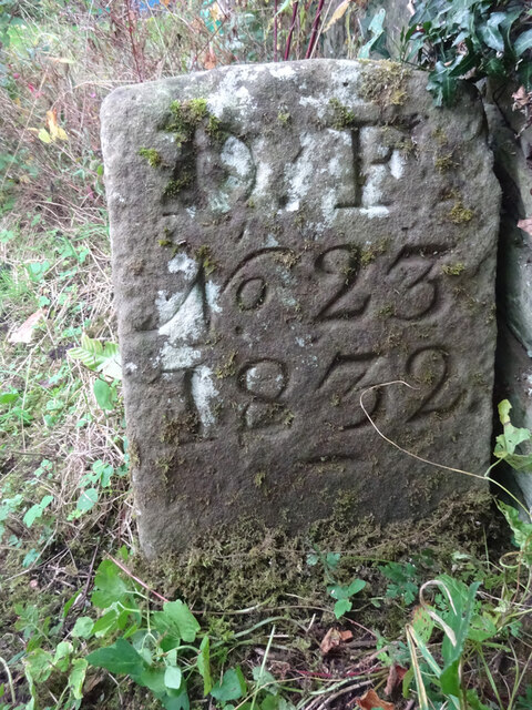
Image: © Mr Red Taken: 4 Oct 2022
Actually in the parish of Awre. In a private garden. By kind permission of the owner who thought they were gravestones until quite recently when they were photographed for a book. One of two in the same garden see Image Inscription: D. F. / Nᴼ. 23 / 1832 Milestone Society National ID: GL_DFAWRE23em
Images are licensed for reuse under creativecommons.org/licenses/by-sa/2.0
Image Location
Latitude
51.758289
Longitude
-2.491698