Parish church [7]
Introduction
The photograph on this page of Parish church [7] by Michael Dibb as part of the Geograph project.
The Geograph project started in 2005 with the aim of publishing, organising and preserving representative images for every square kilometre of Great Britain, Ireland and the Isle of Man.

There are currently over 7.5m images from over 14,400 individuals and you can help contribute to the project by visiting https://www.geograph.org.uk
Parish church [7]
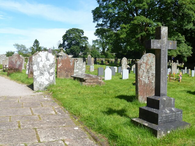
Image: © Michael Dibb Taken: 20 Jun 2022
Part of the churchyard. The Anglican parish church of St Michael has parts from the 12th, 14th and 16th centuries. Constructed of coursed, squared sandstone under lead roofs. Being close to the castle, some 200 yards distant, the church was often targeted by raiding parties from the Scottish borders. Listed, grade II*, with details at: https://historicengland.org.uk/listing/the-list/list-entry/1144902 Brough is a village in the Eden district of Cumbria, some 21 miles northeast of Kendal and about 30 miles west of Darlington. The village is on the A66 road, a key route across the Pennine Mountains via the Stainmore Pass. Brough is on the site of the Roman fort of Verterae and has the ruins of a Norman castle. The village has historically been divided into Market Brough, to the north, and Church Brough, to the south.
Images are licensed for reuse under creativecommons.org/licenses/by-sa/2.0
Image Location
Latitude
54.520058
Longitude
-2.320521