The Shambles in Kingsbridge
Introduction
The photograph on this page of The Shambles in Kingsbridge by Rod Allday as part of the Geograph project.
The Geograph project started in 2005 with the aim of publishing, organising and preserving representative images for every square kilometre of Great Britain, Ireland and the Isle of Man.

There are currently over 7.5m images from over 14,400 individuals and you can help contribute to the project by visiting https://www.geograph.org.uk
The Shambles in Kingsbridge
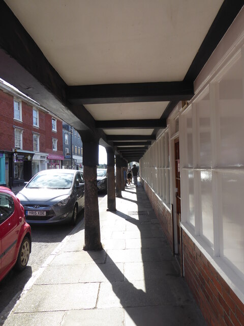
Image: © Rod Allday Taken: 18 Sep 2022
A timber-built Exchange or Market House, referred to as the Chepe House, Butchery or Shambles, formerly stood in the middle of Fore Street, opposite the church. The building, in which the manor courts were held, is shown in a view of the town dated 1586. It was still in existence in 1795, when a legal brief described it as being 128 feet long by 16 feet wide. It was taken down in the following year and replaced by the present Shambles or Market Arcade. This building extends over the pavement next to Saint Edmund's Church. It retains, in its arcade of seven bays, five granite pillars dating from 1586. Behind the arcade are narrow shops. A staircase at the south end leads to offices on the first floor. It is Grade II* Listed. For an exterior view see Image
Images are licensed for reuse under creativecommons.org/licenses/by-sa/2.0
Image Location


Leaflet Map data © OpenStreetMap
Latitude
50.285861
Longitude
-3.77799