The steeple of St Paul's CoI viewed from Bunkers Hill
Introduction
The photograph on this page of The steeple of St Paul's CoI viewed from Bunkers Hill by Eric Jones as part of the Geograph project.
The Geograph project started in 2005 with the aim of publishing, organising and preserving representative images for every square kilometre of Great Britain, Ireland and the Isle of Man.

There are currently over 7.5m images from over 14,400 individuals and you can help contribute to the project by visiting https://www.geograph.org.uk
The steeple of St Paul's CoI viewed from Bunkers Hill
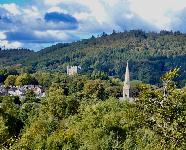
Image: © Eric Jones Taken: 28 Sep 2022
In the background is Castlewellan Castle, the former home of the Annesleys surrounded by its parkland and forests. St Paul's was the place of worship of the Anglican Annesleys and most of their senior retainers.
Images are licensed for reuse under creativecommons.org/licenses/by-sa/2.0
Image Location
Latitude
54.257911
Longitude
-5.938371