Toll House, Ruardean
Introduction
The photograph on this page of Toll House, Ruardean by Mr Red as part of the Geograph project.
The Geograph project started in 2005 with the aim of publishing, organising and preserving representative images for every square kilometre of Great Britain, Ireland and the Isle of Man.

There are currently over 7.5m images from over 14,400 individuals and you can help contribute to the project by visiting https://www.geograph.org.uk
Toll House, Ruardean
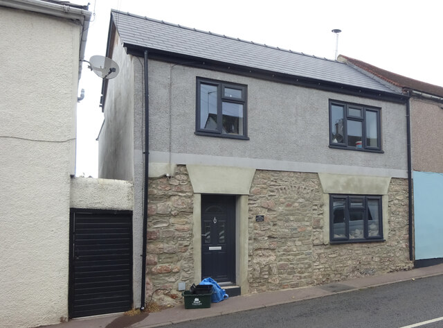
Image: © Mr Red Taken: 27 Sep 2022
Former Toll House, "Pike Cottage" on the North side of High Street. Used by the Forest of Dean Turnpike Trust up until the 19ᵗʰ C. Parts of Ruardean are in the "Forest" but the High Street is not. Milestone Society National ID: GL.RUA
Images are licensed for reuse under creativecommons.org/licenses/by-sa/2.0
Image Location


Leaflet Map data © OpenStreetMap
Latitude
51.856619
Longitude
-2.549934