Richmond houses [92]
Introduction
The photograph on this page of Richmond houses [92] by Michael Dibb as part of the Geograph project.
The Geograph project started in 2005 with the aim of publishing, organising and preserving representative images for every square kilometre of Great Britain, Ireland and the Isle of Man.

There are currently over 7.5m images from over 14,400 individuals and you can help contribute to the project by visiting https://www.geograph.org.uk
Richmond houses [92]
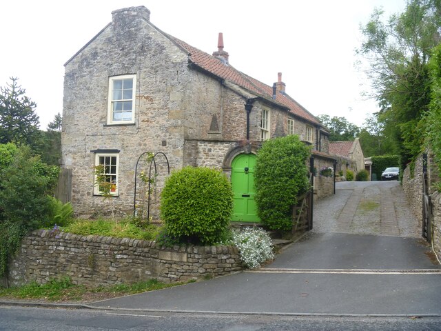
Image: © Michael Dibb Taken: 19 Jun 2022
Garden Cottage, number 1 Cravengate was probably built in the early 19th century. Set gable end to the street, it is constructed of rubble stone under a pantile roof. Incorporated are two 18th century stone archways - one has a keystone and moulded columns, the other has moulded capitals and rusticated keystone. There are also two stone pyramids from 18th century gate piers. Listed, grade II, with details at: https://historicengland.org.uk/listing/the-list/list-entry/1131227 Richmond is a picturesque market town in North Yorkshire, some 13 miles northwest of Northallerton and about 11½ miles southwest of Darlington. Set on the north bank of the River Swale, the town is on the edge of the Yorkshire Dales National Park, and is marketed as the Gateway to the Dales. Richmond was founded in 1071 and the castle was completed in 1086. Tourism is important to the local economy, as is the influence of the nearby Catterick Garrison army base. A traditional market operates every Saturday in the large cobbled marketplace.
Images are licensed for reuse under creativecommons.org/licenses/by-sa/2.0
Image Location
Latitude
54.402598
Longitude
-1.742716