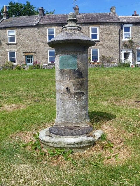
Reeth features [3]
Introduction
The photograph on this page of Reeth features [3] by Michael Dibb as part of the Geograph project.
The Geograph project started in 2005 with the aim of publishing, organising and preserving representative images for every square kilometre of Great Britain, Ireland and the Isle of Man.
There are currently over 7.5m images from over 14,400 individuals and you can help contribute to the project by visiting https://www.geograph.org.uk

Image: © Michael Dibb Taken: 20 Jun 2022
This water pump and trough in Market Place is dated 1868. The cylindrical pump is about 6 feet high, set in a circular trough, all in ashlar. A plaque reads: "This water was brought into the town and these tanks erected by the munificence of Geo. Robinson Esq of Richmond 1868". Listed, grade II, with details at: https://historicengland.org.uk/listing/the-list/list-entry/1131506 Reeth is a village, some 8½ miles west of Richmond, set on a plateau above the River Swale, surrounded by hills and moors. At the junction of roads up Swaledale and Arkengarthdale, Reeth was an important service centre for the lead mines and smelt mills based in these two valleys in the 18th and 19th centuries. Now a centre for walkers and other visitors to the Yorkshire Dales National Park.

