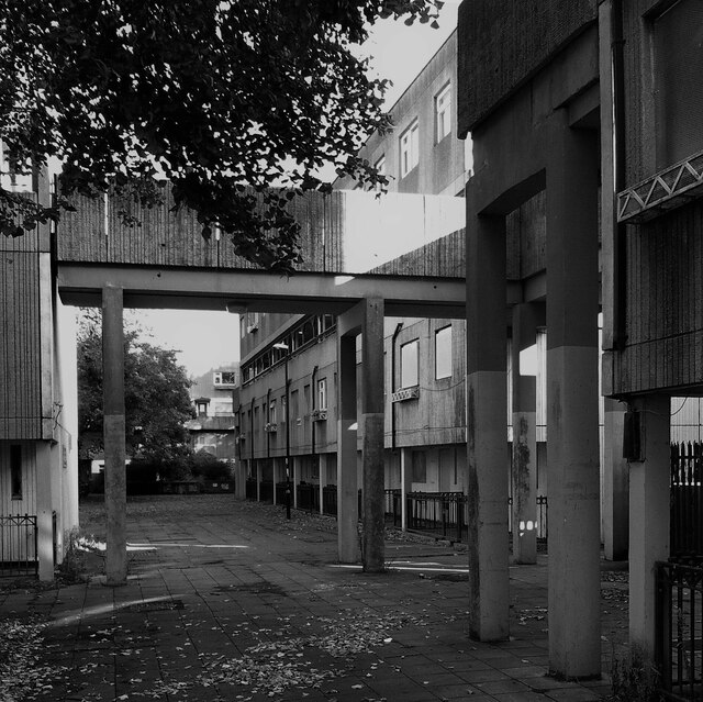
Streets in the Sky, Spon End
Introduction
The photograph on this page of Streets in the Sky, Spon End by A J Paxton as part of the Geograph project.
The Geograph project started in 2005 with the aim of publishing, organising and preserving representative images for every square kilometre of Great Britain, Ireland and the Isle of Man.
There are currently over 7.5m images from over 14,400 individuals and you can help contribute to the project by visiting https://www.geograph.org.uk

Image: © A J Paxton Taken: 1 Oct 2022
A concrete walkway connects the upper rows of two-storey maisonettes in the four storey blocks of Milestone House, Kerry's House & Trafalgar House in Spon End, Coventry. The maisonettes were built in the 1960s by the City Architect's Department under Arthur Ling as part of a programme of slum clearance; see Image] for further information. The maisonettes are themselves now to be demolished and replaced in a programme beginning in 2023, as reported by the Coventry Society https://news.coventrysociety.org.uk/2022/05/16/redevelopment-of-spon-end/ . Many are now empty and boarded up, though others are still lived-in. For the unhappy history of 'streets in the sky' see the Urban Idiot writing for the Academy of Urbanism https://www.academyofurbanism.org.uk/streets-in-the-sky-the-urban-idiot/ . Spon End is at least on a smaller scale than the vast blocks of Park Hill in Sheffield and Hulme in Manchester.
Image Location


