Castlewellan Community Centre, Circular Road, Castlewellan
Introduction
The photograph on this page of Castlewellan Community Centre, Circular Road, Castlewellan by Eric Jones as part of the Geograph project.
The Geograph project started in 2005 with the aim of publishing, organising and preserving representative images for every square kilometre of Great Britain, Ireland and the Isle of Man.

There are currently over 7.5m images from over 14,400 individuals and you can help contribute to the project by visiting https://www.geograph.org.uk
Castlewellan Community Centre, Circular Road, Castlewellan
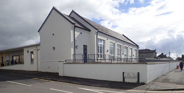
Image: © Eric Jones Taken: 28 Sep 2022
This building was originally the St Malachy's (Catholic) Primary School. After a new parochial school was built adjacent to the parish church, the building was converted into a much need community centre. For some years part of it was occupied by the nascent Bunscoil Bheanna Boirche, Castlewellan's Irish medium school. Following a major growth in pupil numbers this school moved to a purpose-built campus further along the street.
Images are licensed for reuse under creativecommons.org/licenses/by-sa/2.0
Image Location
Latitude
54.256419
Longitude
-5.94044